Best Beaches in Malta and Gozo: Sand or Rocky Shores?
Malta and Gozo beaches by sand, rock and how you get in: Golden Bay, Għajn Tuffieħa, Mellieħa, Ramla, Ħondoq, Sliema rocks and the Blue Lagoon.
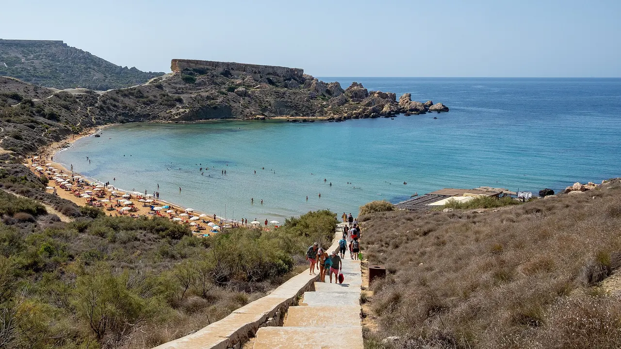
Ramla on Gozo is a long stretch of red sand below protected dunes, and Golden Bay on Malta’s north-west coast is sandy too, with a ramp down to the beach. Għajn Tuffieħa, one headland along, is also sand, but you reach it by a long flight of steps or by footpaths over clay slopes. Fond Għadir on the Sliema promenade is rocky shore, Marsalforn on Gozo mixes sand and small pebbles, and at Ħondoq the sea is reached from bathing ladders beside a small patch of white sand. So choose by the way into the water: it’s what decides a day with children, a cool box or a pushchair.
Check the season as well. By Visit Malta’s reckoning the peak beach season can run until mid- to late October, and in winter the Malta Tourism Authority removes beach infrastructure for maintenance, so off-season you’ll bring your own shade and water, and on any day the flag on the beach decides whether you swim.
| Beach | Island | The way in | Without a car |
|---|---|---|---|
| Golden Bay | Malta, north-west | Sand, ramp down | Route 44 from Valletta (operator’s route page) |
| Għajn Tuffieħa | Malta, north-west | Sand, steps or footpaths | As Golden Bay |
| Mellieħa Bay | Malta, north | Sheltered sand between two headlands | Airport Direct TD1 calls at Mellieħa |
| Fond Għadir | Malta, Sliema | Rocky shore on the promenade | On foot from Sliema |
| Ramla | Gozo, north | Red sand, protected dunes | Route 302 from Victoria; 322 from the Mġarr quay |
| Marsalforn | Gozo, north | Sand and small pebbles, rocks at the sides | Route 322 from the Mġarr quay |
| Ħondoq | Gozo, below Qala | Bathing ladders, small sand patch | Bus; take the route from the trip planner |
Golden Bay or Għajn Tuffieħa: a ramp or a long flight of steps
Golden Bay and Għajn Tuffieħa sit on Malta’s north-west coast, separated by a headland. The Blue Flag national directory lists Golden Bay as one of three rural, sandy beaches on that side and notes a ramp down to the sand. Għajn Tuffieħa is sandy too, but the same directory says it is reached only through a long flight of steps or a network of footpaths winding along the clay slopes.
We’d pick between the two by what you’re carrying. With a cool box, a pushchair or someone who finds steps hard, Golden Bay’s ramp makes the easier day. Travelling light, Għajn Tuffieħa’s steps are fine on the way down, but you’ll want some water and energy left for the long flight back up at the end of a hot afternoon.
Both bays have official Ambjent Malta snorkel trails, covered in our diving and snorkelling guide. The Blue Flag pages still carry old bus details for these two bays, so take the route from Malta Public Transport’s trip planner instead. A single ticket is €2.00 until 12 June 2027 and €2.50 in summer, and our transport guide compares the weekly cards.
Mellieħa Bay: sheltered sand between two headlands
Mellieħa Bay lies on the northern part of Malta, and the Blue Flag directory calls it a sheltered beach between two headlands. Airport Direct TD1 runs north from Malta International Airport to Ċirkewwa through Mellieħa every hour, at €3.50 without a card on the operator’s pages on 17 November 2026.
The same bay is where Scuba Dive Malta runs its Try Scuba session, staying at no more than 5 metres (see our diving guide). If a lifeguard’s on duty, ask which stretch is supervised before you spread out.
Ramla: red sand below protected dunes
Visit Gozo calls Ramla an expansive stretch of red sand, and the protected dunes behind it are part of the view: use the marked approaches and keep your picnic off the dune vegetation. Locals call the beach Ramla il-Ħamra. The same guide mentions a few cafes and a small stall set back from the beach, so in the off-season bring water of your own.
Without a car, route 302 runs to Ramla from the Victoria bus terminus, and route 322 calls there on its way from the Mġarr ferry quay to Xagħra and Marsalforn; on 16 November 2026 the 322 had a 90-minute gap between departures from the quay, so read the return times at the stop when you arrive. The same 322 stops in Xagħra for the Ġgantija temples, which puts a temple morning and a Ramla afternoon on one bus line. Our Gozo guide sets out the island’s other bus routes.
Ħondoq: ladders and a patch of sand
Ħondoq ir-Rummien is below the village of Qala, looking across to Comino. The Blue Flag directory says access to the sea is from bathing ladders and mentions a small white sand beach, so these are two different ways in, and it’s worth looking at both before you pick a spot. If the ladder feels awkward, use the sand patch or pick another bay.
Comino’s Blue Lagoon: reached by boat
The Blue Lagoon is on Comino, the small island between Malta and Gozo, and you reach it by boat. Comino Ferries runs from Marfa and Ċirkewwa in northern Malta, and its €15 adult return includes landing at the lagoon. The crossing takes about 20 minutes, and boats from Marfa left every half hour between 08:30 and 16:00 when we read the operator’s timetable on 17 November 2026.
Landing is regulated. The Malta Tourism Authority introduced a free online booking system (bluelagooncomino.mt) from 1 May 2025, with three daily time slots, 08:00 to 13:00, 13:30 to 17:30 and 18:00 to 22:00, and a cap of 4,000 visitors at any one time; its press release dates from 2 May 2025, so confirm the booking page for your own dates. Boats run subject to the weather, so make the lagoon the day’s main event and don’t pin anything tight to the last boat back. Our transport guide has both piers and the same operator’s connection on to Gozo.
Marsalforn: a promenade with a beach attached
Marsalforn’s beach is sand and small pebbles, backed by a promenade that runs right round the head of the bay, with rocks along each side. Route 322 runs here from the Mġarr ferry quay by way of Ramla, so both bays are a single bus ride off the boat. Ramla is the pick when the beach itself is the plan; Marsalforn when a swim sits between a walk and a meal.
Fond Għadir: rocks on the Sliema promenade
Fond Għadir is listed as a rocky beach, one long stretch of rocky shore along the Sliema seafront. It suits a holiday based around Valletta and the harbour, where a swim is a break in a town day and not a trip north. Wear shoes you can get wet, and look at the entry and the way out before you go in.
Flags, water-quality notices and winter
Malta’s Environmental Health Directorate publishes bathing-water classifications and reports of temporary closures of bathing sites. The directorate’s site classification report is weekly, so open the latest one for the beach you’ve picked.
The Malta Tourism Authority’s flag guidance gives red as high hazard and double red as water closed to the public. Where Malta Red Cross lifeguards are on duty, they assess the sea through the day and set the flags accordingly. The Red Cross lifeguarding page doesn’t give months of cover for individual beaches, so treat a winter beach as unsupervised unless you can see a lifeguard on duty. Blue Flag is an annual award, so check the current list for the year you travel. If the water’s closed on the day, the coastal path and a long lunch still work.
Which beach suits which base
From a Sliema or Valletta base, Fond Għadir is the swim you can walk to. Mellieħa Bay is on the TD1 line from the airport, Golden Bay is on route 44 from Valletta, and with nights on Gozo, Ramla and Marsalforn both sit on route 322 from the Mġarr quay. A bay on your own bus route beats a prettier one with a change of buses on the way back. For the north-west bays or a circuit of Gozo, our car-hire guide covers the car side, and a week with overnight stays on Gozo gives the coast more time. After the sea, the food guide has the pastizzi and the rabbit.
Photos
Read also

Things to do · 7 min read
Diving and Snorkelling in Malta and Gozo
Verified · 17 November 2026Diving and snorkelling in Malta and Gozo: Ċirkewwa wrecks, Gozo shore sites by level, snorkel trails, dive prices and DAN's 12 and 18 hour flying advice.

Car hire · 7 min read
Car Hire in Malta: Driving on the Left, Licences and Gozo
Updated · 17 November 2026Car hire in Malta: driving on the left, which licences work, airport desks, Valletta charge zone and the €15.70 Gozo ferry fare, checked 16 November 2026.

What to see · 6 min read
Ġgantija Temples: Tickets, Hours and Reading the Stones
Verified · 17 November 2026Ġgantija in Xagħra: €10 combo ticket with Ta' Kola, opening hours, painted plaster, two kinds of limestone, access and how to get there.

Regions · 9 min read
Gozo from Malta: Ferries, Base or Day Trip, Where to Go
Updated · 17 November 2026Gozo for visitors from abroad: Gozo Channel fares and how the ticket works, the fast ferry from Valletta, a base or a day trip, and what to see.